Services
IPaC provides a diversified offering of client focused services. Ranging from full phase consulting in focused areas of discipline including: Forestry, Geomatics, Survey & Engineering, Forest Tenure & Fibre management services and our First Nations Partnerships. At IPaC, we provide practical, timely and cost-effective solutions to the varied challenges that our clients encounter. We understand that the future of our business is linked to our ability to provide innovative, quality service to our customers while ensuring the safety of our employees, the public and other job-site workers.


Forestry
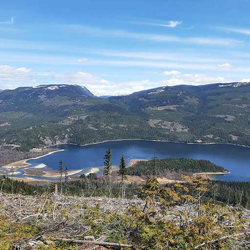
Our team of professionals works seamlessly with customer organizations to find proactive solutions to various challenges facing the forestry sector. IPaC specializes in forestry permitting challenges ranging from small private parcel management to full multi-phase development and fibre management projects.
Forest Health
- Forest Health Hazard & Risk Assessments
- Pest Incidence Surveys
- Pest Management Strategies
- Aerial Mapping of Pest Infestations
- Forest/Urban Interface Studies
Silviculture
- Silviculture Surveys and Prescriptions
- Silviculture Inspection and Auditing
- Tree Planting Implementation
- RESULTS Data Reporting & XML Submissions
Cutting Authority Development
- Harvesting Unit Design and Layout
- Timber Cruising
- Timber Appraisal
- Small Scale Salvage Development
- Global Positioning System Traversing
- Mapping, GIS Database Reporting
- Referrals, Stakeholder Engagement
Environmental
- Sediment and Erosion Control, Monitoring, Reporting, and Prescription.
- Construction Monitoring and Supervision.
- Environmental Certificate Compliance Monitoring.
- Riparian Area and Forest Stream Classification.
- Fish Surveys/Stream Shocking.
- Watershed Assessment and Restoration.
- Sediment Source Surveys.
- Forest Site Remediation.
Compliance & Monitoring
- Coordinate, Prepare, Report, and Other Regulatory Requirements.
Geomatics & Surveys
IPaC surveyors use various GPS, conventional laser and/or hard measure survey methods to provide optimized services and outputs that meet customer needs and budgets. New to our ‘tool set’ as of 2019 is the addition of RTK precision level Drone aircraft. We are Transport Canada licensed and approved for Advanced RPAS operations and are excited to be able to provide the added custom survey services and data collection capability that Drone aircraft can provide. People and survey services are specific to overall project objectives because we recognize that not all projects require the same level of accuracy. We work in both urban and remote locations, for municipal and government agencies, and resource development companies in the forestry, mining, oil and gas and energy sectors, and government alike. CAD drawings and maps are tailored to client needs and range from standard drawings to innovative drafting solutions.
Road and Bridge Design
- Geometric Road Design (Plans, Profiles, Cross Sections, Mass Haul Diagrams)
- General Arrangements (Bridges, Conventional Culverts, Arch Culverts, Retaining Walls)
- Detailed Structural Design (Bridges, Arch Culverts, Retaining Walls)
Route Location Surveys
- Road Reconnaissance and P-Line Layout
- Feature Siting (Archeological, Hydrological, Structural)
- Site Plans (Drainage Structures, Pipeline Crossings, Rail Crossings)
- Right-of-Way/Clearing Extents Location and Survey
Construction Surveys
- Pre-construction, Pre-design Surveys
- Design, Staking and Feature Location
- As-built surveys
Underground Locates
- Pipeline crossing location surveys
- Underground Services (Municipal, Industrial) location services
CAD
The CAD department provides mapping and drafting services to suit customer needs. Software used includes AutoCAD 2015, Civil 3D, Eagle Point 2008, and various GPS data processing and correction (Trimble, Pathfinder, Viasat, etc.) packages.
Procurement and Construction Supervision
- Planning, Logistics, Constructability Assessments, Budgeting, Stakeholder Engagement, Referrals, Notifications, Advertising, Permitting
- Public Safety, Traffic Management Plans, Signage
- Contract Preparation, Tendering, Bid Evaluations, Contract Award Recommendations
- Project Management, Construction Supervision
Crossing Surveys
- Bridge and Culvert Site Plans
Topographic Surveys
- Surface Modeling
- Earthwork Quantities
- Implementation of Lidar Survey Data
Survey Tools
- GPS (Trimble R8 GNSS RTK, Trimble R10 GNSS RTK, Trimble, Garmin)
- Total Station EDM
- Steel Chain/Clinometer/Hand Compass
Computer Aided Drafting
IPaC provides full phase mapping, GPS processing, and file submission services with extensive experience interfacing with many major public and private resource management systems. Software used includes ArcMap 10.x, FME, GPS (Trimble, Viasat, etc.) packages, Trimble, RESULTS.
Database Development
The IT department provides customized database development and reporting services. Microsoft products, SQL Server and MS Access, are the typical development environment, supported with SQL, Visual Basic, and Visual Studio C# programming code.
Terrain Modelling and Simulation
IPaC provides terrain modeling and visual analysis to assist customers to meet specific visual objectives or targets after various landscape/viewscape disturbances, including harvesting units, other clearing works or structures. Integrated Visual Designs (IVD), Visual Impact Assessments (VIA), and photo realistic perspective views are typical products produced. IPaC uses VNS 3 and World Construction Set software.
Geographic Information Systems
Industry leading software packages are utilized for advanced resource data analysis, thematic mapping and terrain modelling. Software options include ArcInfo 9.x, ArcMap 9.x, Safe FME, SQL server and MS Access.
Hardware and Software Support
The IT department provides customized hardware and software support services to a select group of clients.
Forest Tenure & Fibre Management
At IPaC, we provide Forest Tenure management services as well as Fibre Marketing services. Satisfied clients include major forest industry mills, private land owners, BC Timber Sales operators, value-added / specialty mills, BC Parks, utility companies, Ministry of Highways, First Nations, private investors, and woodlot / small tenure licensees.
Log Marketing & Brokering
- Timber Assessments
- Market sourcing for appropriate products
- Value maximization for composite product profiles
- Sourcing of harvest contractors
- Sourcing of log transport (barge, truck, etc.)
- Accounting Services, Receivables / Payables / Statements and Contractor Pays
- Statistical stand volume measurement
- Private property line identification assistance
Forest Tenure Management
- Non-Replaceable
- Forest Licences
- Woodlot Licences
- Undeveloped Timber Sales
- Private Land Timber Management
- Accounting Services, Receivables / Payables / Statements and Contractor Pays
- Logging and Road Construction Supervision
Fibre / Log – Lumber Trade Agreements
- Specialty Log Purchases / Sorting / Trading
- Private Timber Assessments and Evaluations
- Log Exports (U.S.A., China)
- BC Timber Sales Program Bidding Services